
How a dedicated cohort of local rangers, equipped with high-precision GIS mapping and satellite navigation, bridged custom and national law to permanently shield 2,897 hectares of primary cloud forest from commercial logging and industrial mining.
by Cornelius Qaqara Isabel Province
In a landmark victory for indigenous land stewardship and tropical forest conservation across the South Pacific, the local community rangers of the Sasari Protected Area in Isabel Province have successfully completed a comprehensive spatial boundary mapping and functional land-use evaluation campaign.
Conducted from September 7 through September 11, 2026, deep within the primary rainforests of the Varanitu customary estate, this intensive field operation marks a decisive turning point in the sovereign protection of indigenous lands.
For decades, the ultra-biodiverse ridge-to-reef ecosystems of Isabel Province – spanning lowland riverine habitats, submontane hill forests, and transitional cloud forests rising to the 1,177-meter summit of Mount Sasari- have faced persistent existential threats.
Predatory commercial timber logging operations and aggressive industrial mining concessions have continually sought to exploit the island’s pristine natural capital.
In response to these encroaching environmental pressures, the indigenous Sasari Phosamogo tribe mobilized in 2018 to establish a community-led conservation refuge, pledging to permanently safeguard 2,897 hectares of their ancestral inheritance, within which the core 2,327-hectare Sasari Protected Area is situated.
However, while voluntary tribal declarations provide essential customary moral authority, national statutory law mandates that long-term legal immunity against resource extraction requires explicit spatial coordinate schedules, standardized land-use zoning, and a government-endorsed Management Plan submitted to the Ministry of Environment, Climate Change, Disaster Management and Meteorology (MECDM).
Without formal statutory registration under the Solomon Islands Protected Areas Act 2010 and Protected Area Regulations 2012, community-declared reserves remain inherently vulnerable to external legal challenges, boundary encroachments, and commercial resource exploitation.
Ranger Workshops and Customary Map Reviews
Addressing this legal vulnerability head-on, the five-day technical deployment – facilitated by spatial specialists alongside institutional partners including The Nature Conservancy (TNC) – began with intensive capacity-building workshops.
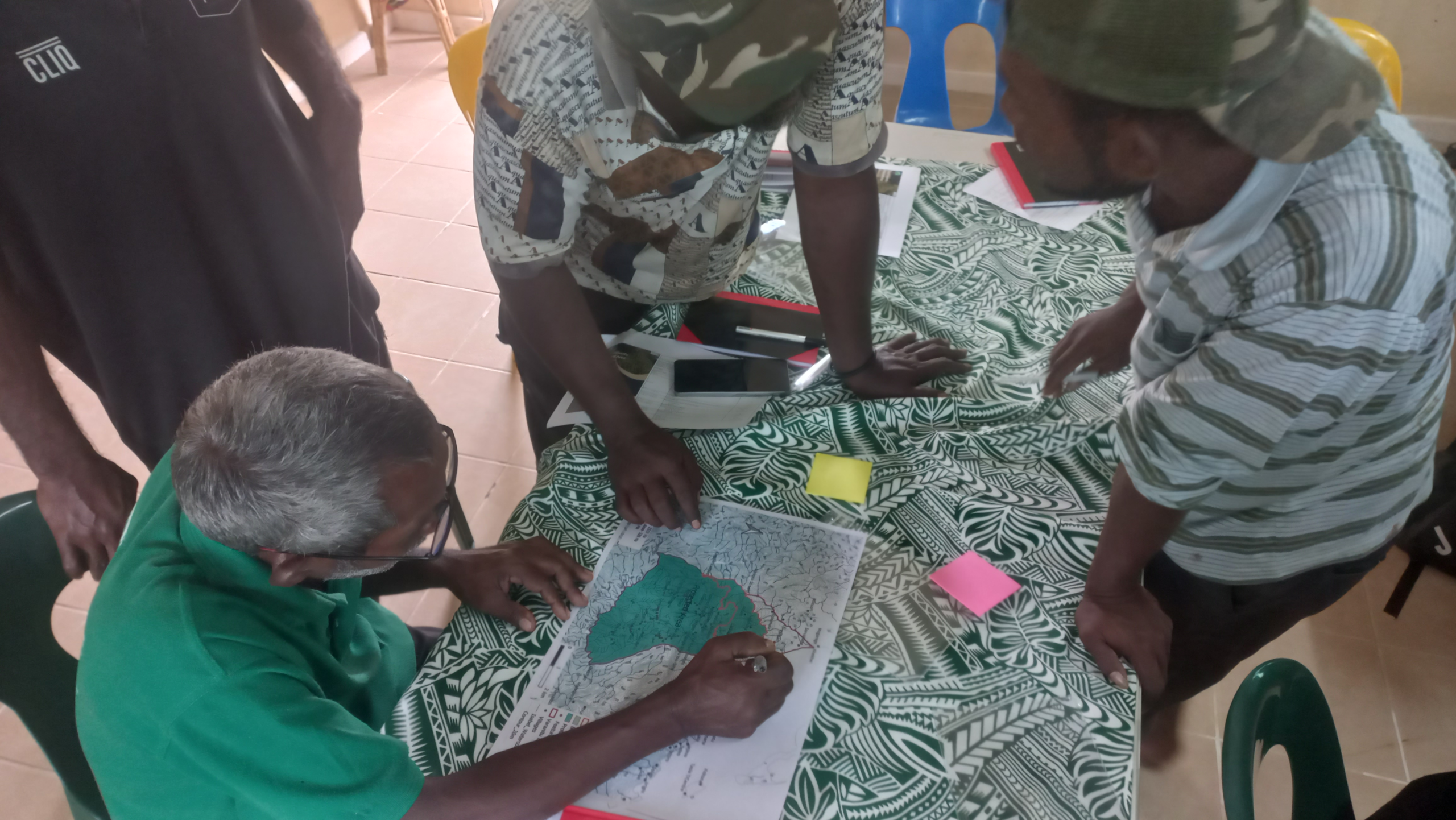
Local indigenous rangers convened at the Varanitu community hub to systematically bridge orally transmitted customary history with modern geographic information systems (GIS).

During the initial workshop sessions, rangers collaborated with GIS analysts to conduct rigorous map reviews of the customary estate.
Elders and knowledge holders shared deep spatial accounts of ridges, rivers, ancestral hunting grounds, and sacred sites (Tambu areas).
The rangers scrutinized existing satellite imagery, topological terrain models, and historical logging concession maps.
By overlaying tribal oral maps onto modern cartographic basemaps, the team identified critical boundary keypoints, potential overlap zones with neighboring customary groups, and priority areas requiring high-precision physical verification in the field.
Advanced GPS Training & Field Data Collection
Following the theoretical alignment sessions, the ranger cohort underwent intensive field-based satellite navigation and spatial methodology training.
Equipped with handheld high-precision Global Positioning System (GPS) units, ruggedized digital data collectors, and spatial mapping software, the rangers learned to execute multi-constellation satellite tracking, record precision waypoint data, and track line geometries along dense forest canopy paths.
Over three days of relentless ground surveys across rugged montane topography, the ranger team executed a thorough field data collection campaign, achieving 100 percent coverage of the required spatial data.
Navigating treacherous mountain slopes, dense transitional cloud forests, and river corridors rising toward the peak of Mount Sasari, the team systematically recorded every operational baseline, customary boundary marker, and functional human-use zone embedded within the Varanitu landscape.
Rangers documented critical ecological indicators, primary forest stands, community water catchments, traditional agricultural plots, and historic cultural landmarks.
This rigorous field effort ensured that every line drawn on the future management map corresponded exactly to verified physical and customary reality on the ground.
The Final Land Use Plan Map & Zoning Framework
The extraction and computational processing of the vector GIS field data culminated in the creation of an authoritative final Land Use Plan Map.
To ensure both ecological integrity and long-term community support, the spatial design establishes six distinct, non-overlapping functional land-use zones engineered to balance strict environmental preservation with sustainable customary livelihoods:
| Zone Classification | Area (Hectares) | Permitted Activities & Statutory Rules |
| Core Protected Area (Dark Green) |
2,313 ha | Strict biodiversity conservation, fauna/flora monitoring, scientific research, and low-impact ecotourism. Commercial logging, mining, agricultural clearing, and hunting are strictly prohibited. |
| Agricultural & Garden Zones (Orange) |
147 ha | Designated exclusively for local subsistence farming, traditional crop rotation, and food security. Encroachment into primary forest is barred. |
| Sustainable Timber Milling Zone (Pink) |
53 ha | Controlled timber extraction strictly for community housing and local infrastructure. Managed under annual harvest quotas; commercial timber export is banned entirely. |
By establishing clear spatial boundaries between strict sanctuary areas and human utilization zones, the Land Use Plan Map eliminates internal resource conflicts while providing an indisputable legal framework that prevents external commercial encroachment.
Statutory Submission & The Path to National Gazettement
The successful field exercise yielded three vital statutory submission deliverables required for formal government recognition under Solomon Islands law:
High-Resolution Vector Boundary & Land-Use Map: A precise spatial map detailing all boundary coordinates, elevation profiles, and non-overlapping functional zones.
One-Page Statutory Management Plan: A legally structured governing document outlining explicit environmental prohibitions, ranger enforcement powers, and penalty schedules pursuant to the Protected Area Regulations 2012.
Complete MECDM Registration Package: A fully compiled dossier containing verified coordinate schedules, verified landholder consent documentation, and tribal governance structures.
As the compiled application package advances to the Ministry of Environment, Climate Change, Disaster Management and Meteorology (MECDM) for formal national gazettement, the Sasari initiative stands as an inspiring regional model of indigenous-led environmental self-determination.
By combining centuries of customary ecological wisdom with modern geospatial technology, the rangers of the Sasari Protected Area have demonstrated that local communities can successfully take control of their own conservation destinies – permanently shielding vital carbon sinks, pristine cloud forest biodiversity, and ancestral lands from predatory commercial exploitation for generations to come.
You must be logged in to post a comment.